Capacity Crowd Brews Up Plans for Willamsburg/Greenpoint Greenway
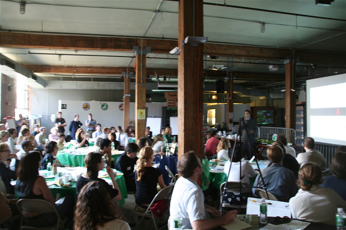
Close to 100 people - mostly Greenpoint and Williamsburg residents - crammed the Brooklyn Brewery's tasting room Thursday evening
The evening featured an interesting presentation from the NYC DOT's Ryan Russo, who explained that the DOT is under a mandate from the Bloomberg administration to add 200 miles of marked bike lanes in the next two years: the first 40 miles to be completed by next month, and the remaining 160 miles by June 2009. Douglass Adams, from planning consultant Sam Schwartz PLLC, served up some basic guidelines for potential street realignments along West Street and Kent Avenue that would allow the addition of bike lanes along that north-south corridor. And tasty sandwiches were served.
But the real meat & potatoes of the evening was the breakout groups, where each of about 10 tables - each seated with randomly-mixed residents and one or two facilitators - discussed issues ranging from "connections to bridges" to "the Greenway in large parks", in an attempt to gather concrete recommendations for a build-out plan for the Greenway. Following the hour-long charette, each table reported their recommendations and showed sketches and maps as visual support.
The suggestions were varied, but the enthusiasm was common. Most of the bike-lane recommendations fell into one of two camps:
A. Provide fast, straight, and protected bike lanes along Kent Avenue and West Street, allowing for a safe, efficient commute. The big issue here being how to protect cyclists from traffic crossing the two streets, particularly the anticipated traffic entering and exiting the new high-rise residential developments.
B. Focus all Greenway development on the water's edge, building an uninterrupted and safe bicycle and pedestrian route with glorious views and safely removed from automobile traffic.
While the idealist side of us loves option b for the long-term, the jilted, upstate pragmatist in us senses that option A - free of the inevitable eminent domain, right-of-way, and water's edge construction issues and undoubtedly cheaper - is the one that's likely to be funded and constructed in our lifetime. The water's edge promenade is a terrific goal, and one that's already in the works via the developers' incentives contained in the 2005 rezone.
But given that the current riverfront contains a power plant, fuel oil tank farms, the Domino Sugar complex, and dozens of operating businesses, putting all of our eggs in that basket strikes us as likely to postpone breakfast for years to come.
In either case, the session was a rare upbeat public meeting, and we're glad we were able to participate. BTW, the Greenway Initiative has a wonderful (and nearly indestructible) Greenway Map, as well as a spiral-bound Greenway Guide available free of charge.
Details on the Greenway [brooklyngreenway.org]
posted by i'mnotsayin @ 9:40 AM
1 comments
![]()


1 Comments:
米蘭情趣用品,情趣用品,情趣,飛機杯,自慰套,充氣娃娃,AV女優.按摩棒,跳蛋,潤滑液,角色扮演,情趣內衣,自慰器,穿戴蝴蝶,變頻跳蛋,無線跳蛋,電動按摩棒,情趣按摩棒
辣妹視訊,美女視訊,視訊交友網,視訊聊天室,視訊交友,視訊美女,免費視訊,免費視訊聊天,視訊交友90739,免費視訊聊天室,成人聊天室,視訊聊天,視訊交友aooyy
哈啦聊天室,辣妺視訊,A片,色情A片,視訊,080視訊聊天室,視訊美女34c,視訊情人高雄網,視訊交友高雄網,0204貼圖區,sex520免費影片,情色貼圖,視訊ukiss,視訊ggoo,視訊美女ggoo
080苗栗人聊天室,080中部人聊天室ut,ut影音視訊聊天室13077,視訊做愛,kk777視訊俱樂部,上班族聊天室,聊天室找一夜,情色交友,情色貼片,小瓢蟲情色論壇,aio交友愛情館
Post a Comment
<< Home